
Part of my own research related to Turf to Tools, and personal project at the Scottish Sculpture Workshop, was to spend more time 'on the land' around Lumsden. A primary objective was to visit the Iron Age hill fort of Tap o'Noth at Rhynie. This is the imposing feature that dominates the local landscape - seen in the heading image I have been using for the documentation of my OAC Project Grant.
A full description of the site can be found on the Scotland's Places web site, along with one of the best collection of images:
The Tap o' Noth is a conical eminence which rises from the W end of the Hill of Noth to attain a height of 1851 ft (564m) OD, and 1300 ft (396m) above the Water of Bogie at Rhynie; it is visible from the sea, 30 miles to the E. The fort that crowns this site is the second highest in Scotland and consists of a single wall (now overgrown and heavily vitrified) which may have originally been more than 20ft (6.1m) thick and encloses an area about 335ft (102m) by 105ft (32m).A number of less specific web sites include this (un-documented) quote:
Archaeological finds from the site include a stone axe head dated to between c2000BC–c800BC, and a decorated bronze rein-ring dated to the 1st–3rd century AD.Also recommended is the Historic Environments Scotland web site, which has an even larger collection of images and a full bibliography cited.
It is clear that Tap o'Noth represents a very significant effort over a long term occupation, bridging the Scottish Bronze through Iron Ages. (Curiously, the much more detailed archaeological description from the two web sites given do not include any listing of artifact finds or suggested dating).
 |
| Locating Top 0'Noth by Rhynie (direct scan) |
 | |
| Enlarged - Showing the trail from the car park, over to the west and up to the summit. (direct scan) |
 |
| Ariel View - roughly from West (image poached off the internet) |
 |
| View up the trail on the west side - looking roughly north |
 |
| View from the Tap - roughly from red circle towards the SW. |
 |
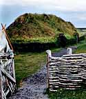
| View of the fort interior - from the NW corner, looking back roughly East. (Note Kelly for scale roughly centre frame.) |
 |
| From the other edge of the oval (NW - left of this image overlaps right of above). |
 |
| Section of vitrafied stone wall (NW side, north edge |
 |
| View of vitrafied stone wall (NW side, south edge) |
The main sections of the vitrafied stone walls shows to the same NW side of the ramparts. The appearance is almost like a dark grey concrete holding together the random pile of lighter grey stones. The stones have been subjected to extreme heat, causing them to partially melt and fuse together to a solid mass. The effect is a bit like the texture of a marshmellow and rice crispy square (familiar to most North Americans). Note that the dark colour seen here is an effect of the lighting and the individual stones themselves.
Originally it was thought that a wooden palisade wall had caught fire then collapsed to create the heat to fuse the stones. On more careful consideration, it is now interpreted that purposeful stacking and firing would have been required to create the duration and high temperatures required. The purpose would have been to strengthen the piled rubble walls of the fortress.
In many of the images, there is a specific location marked.
I stopped at that position, on the roughly 'east' end of the oval construction, just to the south side of the current entrance pathway. Standing on top of the curtain wall of piled stones, I shot a series of linked images to put together a full 360 panorama view of the countryside (unfortunately I'm having trouble getting that specific image to upload here).
 |
| Partial panorama view, from SE corner, view of the fort |
Looking down at my feet, I saw what appeared to be perhaps an original post hole. This was the only hole like this I had observed on walking the entire upper curtain wall. The hole had been recently filled back in with medium sized stones. The stones were clearly 'fresh' on their edges. I can only imagine someone decided the small hole represented some kind of tripping hazard and decided to gather up some stones to fill it to level. The interior of the hole was covered with moss and lichen, normally a process that takes considerable time to evolve. I was bothered by this modern intrusion, and decided to remove the inserted stones to clear to the 'original', moss lined, interior.
 |
| General overview of the 'post hole' - after clearing. |
 |
| Cleared hole, showing moss covered interior. Pen for scale = 14 cm |
Looking more carefully over the small stones in the area around the hole - this is what turned up:
 |
| 'Stones' from around hole - far left roughly 55 mm in diameter. |
The primary material was obviously deposited as a liquid, several pieces were attached to fist sized stones. The best example was composed primarily of the black material, which had encased at least one small stone. There are pockets on the surface where the material has flowed and solidified around other stones (now pulled free). The material is fairly dense, but filled with small bubbles of varying size, some of which are flattened and drawn out to oval shapes.
 |
| Detail A - Possible Iron Smelting Slag - showing small stone encased to bottom right. |
 |
| Detail B (reverse) - Possible Iron Smelting Slag |
Now - I have seen a lot of iron smelting slag.
Another feature on the piece above (not seen in those images) is an area that looks exactly like slag that has flowed around a small piece of charcoal. The linear grain pattern of the partially consumed wood is clear.
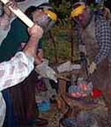
Micheal Nissen had brought a sample piece of tap slag from a Medieval dated iron furnace to display at the Poland Symposium. It showed identical reddish colours on its exposed surfaces (oxidation effect).
To my eye, this sample especially, looks like iron rich slag from the bottom bowl area of a direct reduction bloomery iron furnace.
This suggests, given the remnants of identical material clinging to the stones framing at least the upper edges of the hole, that this may in fact be part of the vary base area of a 'slag pit' style iron smelting furnace.*
If correct, this provides an excellent reference for the entire Turf to Tools project. It illustrates bloomery iron production at Rhynie itself. The activity may not be directly related in time to the carving of the Rhynie Man figure - which itself was a core element to T2T.
* Now, 20 cm ID is certainly on the small side. We have in fact worked successfully to produce iron in a furnace at that diameter ( Smelt #32 - April 2008)


No comments:
Post a Comment